
About All Tours Sunrise ToursSunset ToursSunrise Bike ToursBike ToursPrivate ToursStargazing & Astronomy Tours Directions Hours & Fees
Find Tours 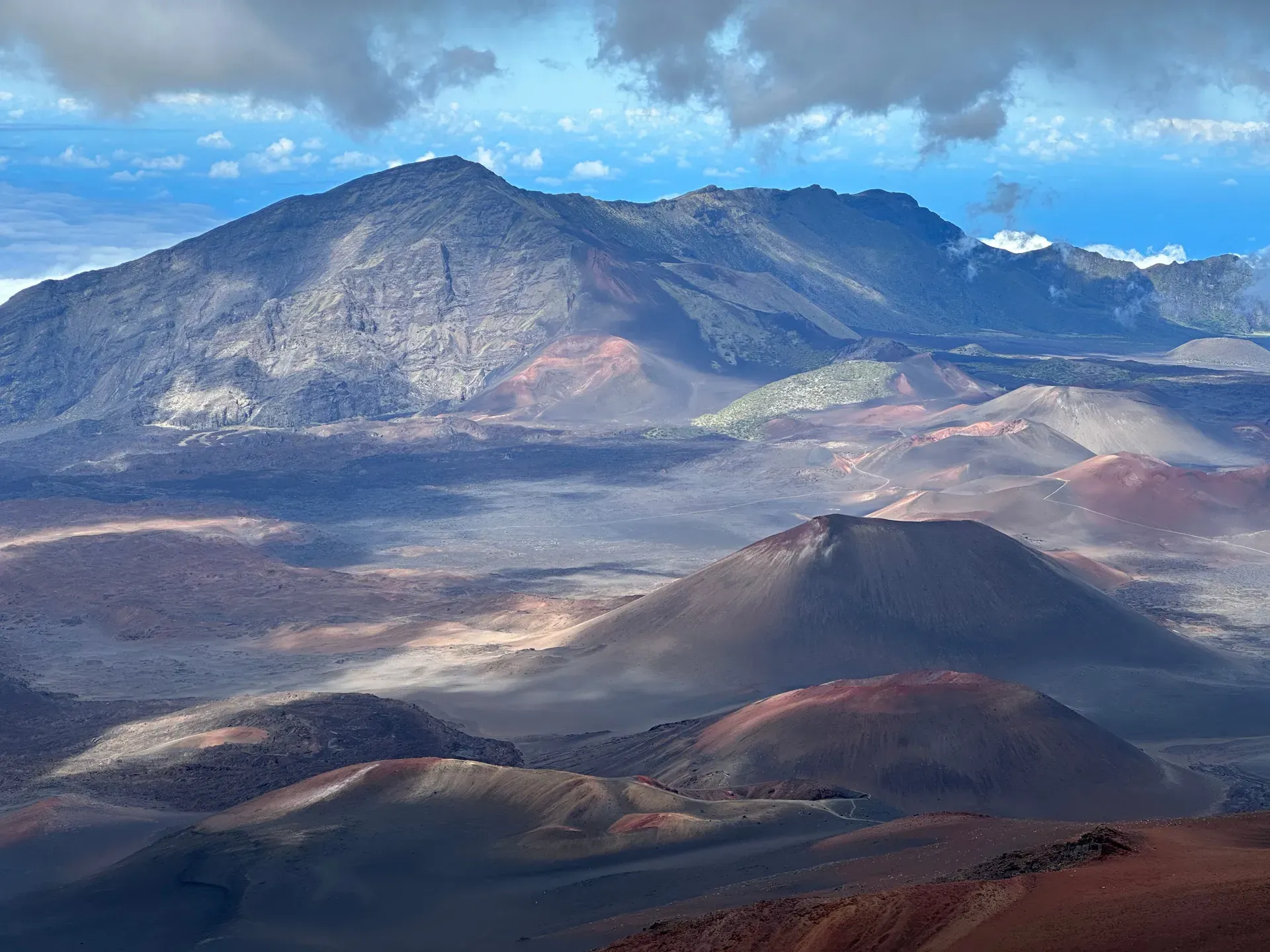
Rising 10,023 feet above the Pacific Ocean, Haleakalā forms more than 75 percent of the island of Maui. This active shield volcano features an isolated alpine ecosystem at its summit that drops steeply into the coastal rainforests of the Kīpahulu District.
Haleakalā dominates the eastern half of Maui, extending tens of thousands of feet below the ocean surface before peaking at 10,023 feet. The active shield volcano comprises more than 75 percent of the island's total landmass. The national park spans 33,265 acres, splitting into two distinct, non-contiguous sections that showcase extreme ecological contrast. The Summit District features a high-altitude, desert-like environment of red cinder cones, freezing temperatures, and thin air. Forty miles away, the Kīpahulu District hugs the eastern coastline, defined by dense bamboo forests, cascading waterfalls, and thick sub-tropical humidity.
Visitors driving the steep, 10-mile Haleakalā Highway experience a 30 to 50-degree Fahrenheit temperature drop between the coastal towns and the summit. The air thins significantly at the Puʻu ʻUlaʻula overlook, making breathing noticeably harder for those unaccustomed to high elevations. Clouds often blanket the mid-elevations around 6,000 feet, leaving the peak exposed to harsh, unfiltered sunlight and howling winds. At Hosmer Grove, located just below the cloud line at 6,800 feet, introduced eucalyptus and cedar trees drip with mist while rare endemic Hawaiian honeycreepers chirp in the canopy. Accessing the summit between 3:00 am and 7:00 am requires a $1.00 sunrise reservation booked through Recreation.gov, while standard entry costs $30.00 per vehicle and remains valid for three days.
Extreme weather dictates access and safety throughout the year. Winter storms routinely bring bone-chilling hail and thick cloud walls to the summit, dropping visibility to zero in minutes. During these wet months, heavy rain on the coast forces immediate closures of the Pools of ʻOheʻo due to severe flash flood risks. Trails in both districts turn muddy and slick. The drier summer months offer the most stable weather for hiking the 30 miles of wilderness trails and stargazing under clear skies. Check the official National Park Service website for daily alerts before driving up the mountain, as conditions change rapidly.
Lava broke the ocean surface approximately one million years ago, building the massive shield volcano layer by layer through countless eruptions. Early Polynesians established settlements in the coastal Kīpahulu area between 1164 A.D. and 1384 A.D., relying on the fertile volcanic soil and abundant rainfall for agriculture. Carbon dating of ancient agricultural terraces confirms this timeline. Native Hawaiians utilized the high-altitude environment extensively despite the freezing temperatures. They quarried dense basalt near the summit to craft koʻi (adzes), essential tools for woodworking and carving out large voyaging canoes. The clear, dark skies above the cloud layer provided a reliable, natural observatory for celestial navigation training.
Three missionaries—Richard Green, Lorrin Andrews, and William Richards—recorded the first written account of a summit ascent in 1828. Their documentation introduced the massive summit depression to the western world. Federal protection began decades later in 1916 when Congress established Hawaii National Park. This original designation grouped Haleakalā with Kīlauea and Mauna Loa on the Big Island, attempting to preserve the most prominent volcanic features in the territory. The territorial government completed the winding summit road between 1933 and 1935, employing local laborers during the Great Depression. This engineering project required blasting through solid basalt and navigating extreme elevation gains to replace rugged horse trails with automobile access.
The Civilian Conservation Corps transformed the visitor experience during the late 1930s. Crews constructed the Haleakalā Visitor Center in 1936 using native stone to blend with the surrounding volcanic landscape, battling thin air and freezing temperatures during construction. The following year, they built a network of backcountry cabins at Palikū and Hōlua. Hikers still reserve these rustic shelters today, sleeping on wooden bunks miles away from the nearest road. Recognizing the distinct ecological and geological differences between the islands, the federal government split the protected areas. Haleakalā officially became a separate national park in 1961.
Today, the park operates as an International Biosphere Reserve, managing 24,719 acres of designated wilderness. It protects the highest concentration of endangered species of any US national park. Biologists strictly enforce rules against off-trail hiking to shield the fragile silversword plants and nesting nēnē (Hawaiian geese). Conservationists face constant battles against invasive species like feral pigs and Argentine ants that threaten the native ecosystem. Visitors arriving from Kauai or Hawaii Island must clean their hiking gear with a 70 percent alcohol solution to prevent the introduction of Rapid ʻŌhiʻa Death, a fungal disease decimating native forests across the state.
An 11.25-mile-wide erosional depression dominates the summit of Haleakalā. Often misidentified as a volcanic crater, this massive valley actually formed through centuries of water erosion and massive landslides. Two major drainage valleys, the Koʻolau Gap to the north and the Kaupō Gap to the south, eroded the rock inward until they coalesced near the center. The resulting basin measures 3.2 miles across and drops nearly 2,600 feet below the rim. Standing at the Kalahaku Overlook at 9,324 feet, visitors can see the entire expanse of this carved landscape. A short drive away, the Leleiwi Overlook provides a 0.25-mile nature trail at 8,840 feet, offering shifting views of the clouds rolling over the volcanic ridges. The highest point, the Puʻu ʻUlaʻula Overlook, features a glass-enclosed observation building accessible via a steep ramp.
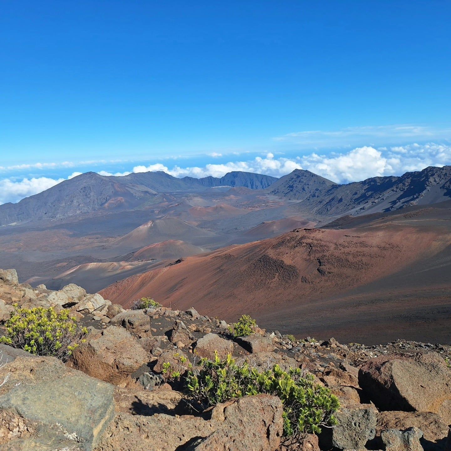
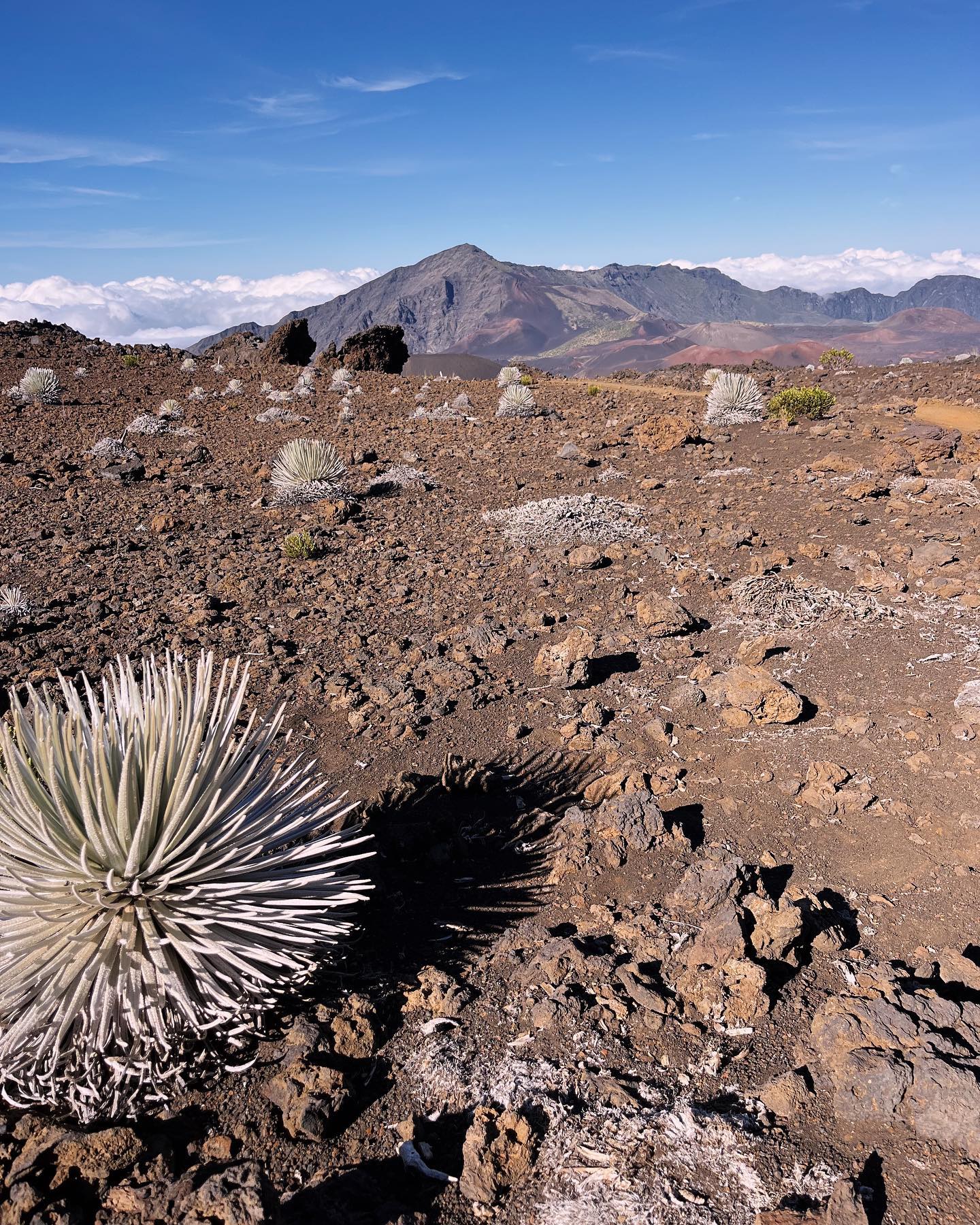
The Sliding Sands (Keoneheʻeheʻe) Trail descends directly into this basin from the summit parking lot. Hikers traverse a lunar-like landscape of loose red, brown, and black cinder, with the red hues created by high concentrations of iron oxide. Towering cinder cones dot the valley floor, marking the sites of more recent eruptions. The high altitude creates an isolated alpine shrubland where the rare Haleakalā silversword grows. This silver, spiky plant lives for up to 90 years, blooms exactly once with a massive stalk of purple flowers, and then dies. The harsh sunlight reflects off the metallic hairs on its leaves, protecting the plant from extreme UV radiation.
Down at sea level, the Kīpahulu District showcases the volcano's wet, windward side. The Pipiwai Trail climbs through a dense, towering bamboo forest that blocks out the sun. The hollow stalks clatter loudly against each other in the wind, creating a hollow, percussive soundscape. Hikers pass the 184-foot Makahiku Falls overlook before the four-mile round-trip trail terminates at Waimoku Falls. Here, water plunges 400 feet down a sheer, moss-covered lava rock wall. The spray hits your face 20 meters before you reach the base of the falls. Coastal erosion formed the nearby Pools of ʻOheʻo, a series of tiered, freshwater basins. Fast-flowing streams of cold mountain runoff cascade down the gulch, filling these dark rock pools before emptying directly into the rough Pacific Ocean. Visitors walking the 0.5-mile Kūloa Point Trail can feel the humidity and hear the crashing surf long before the pools come into view.
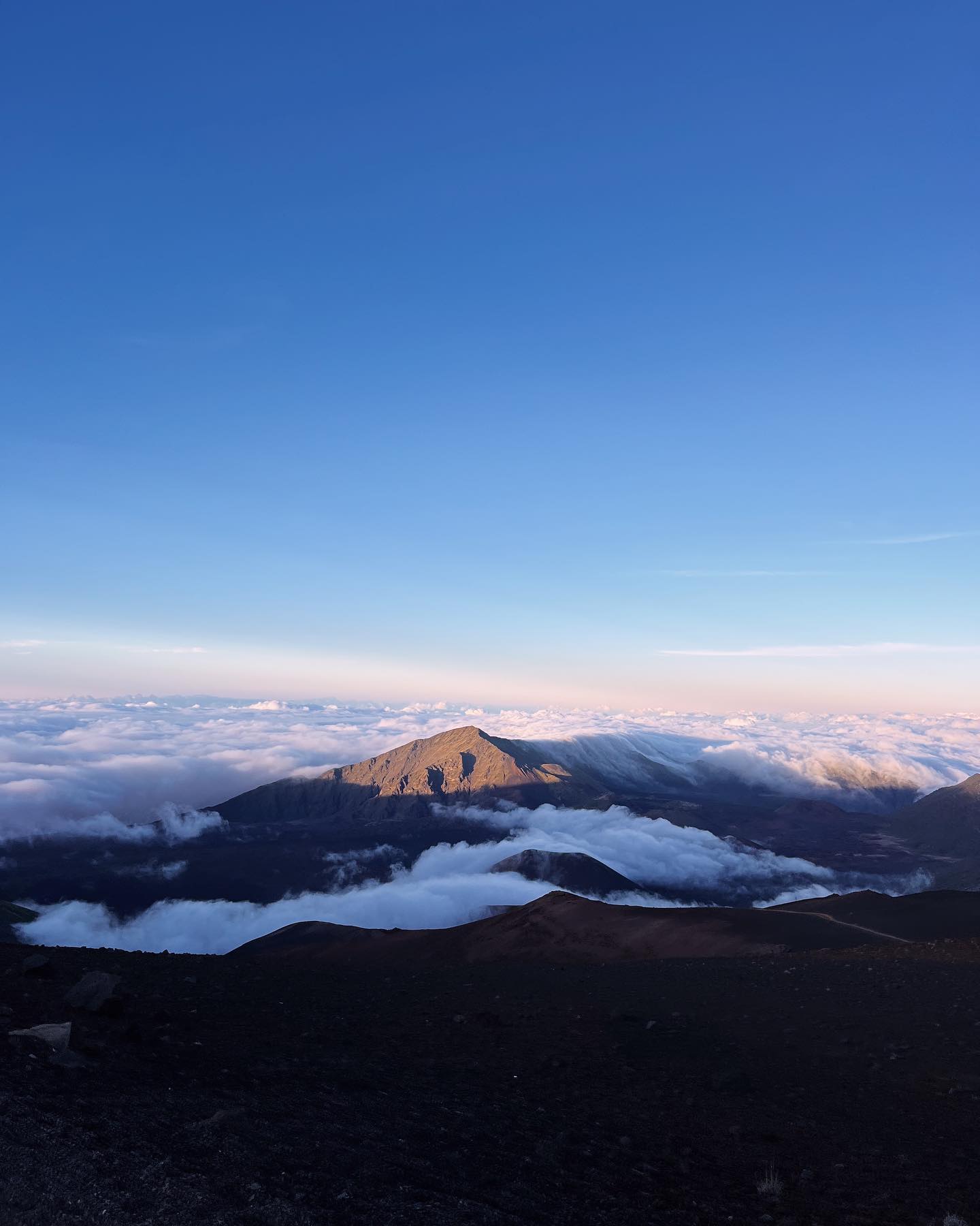
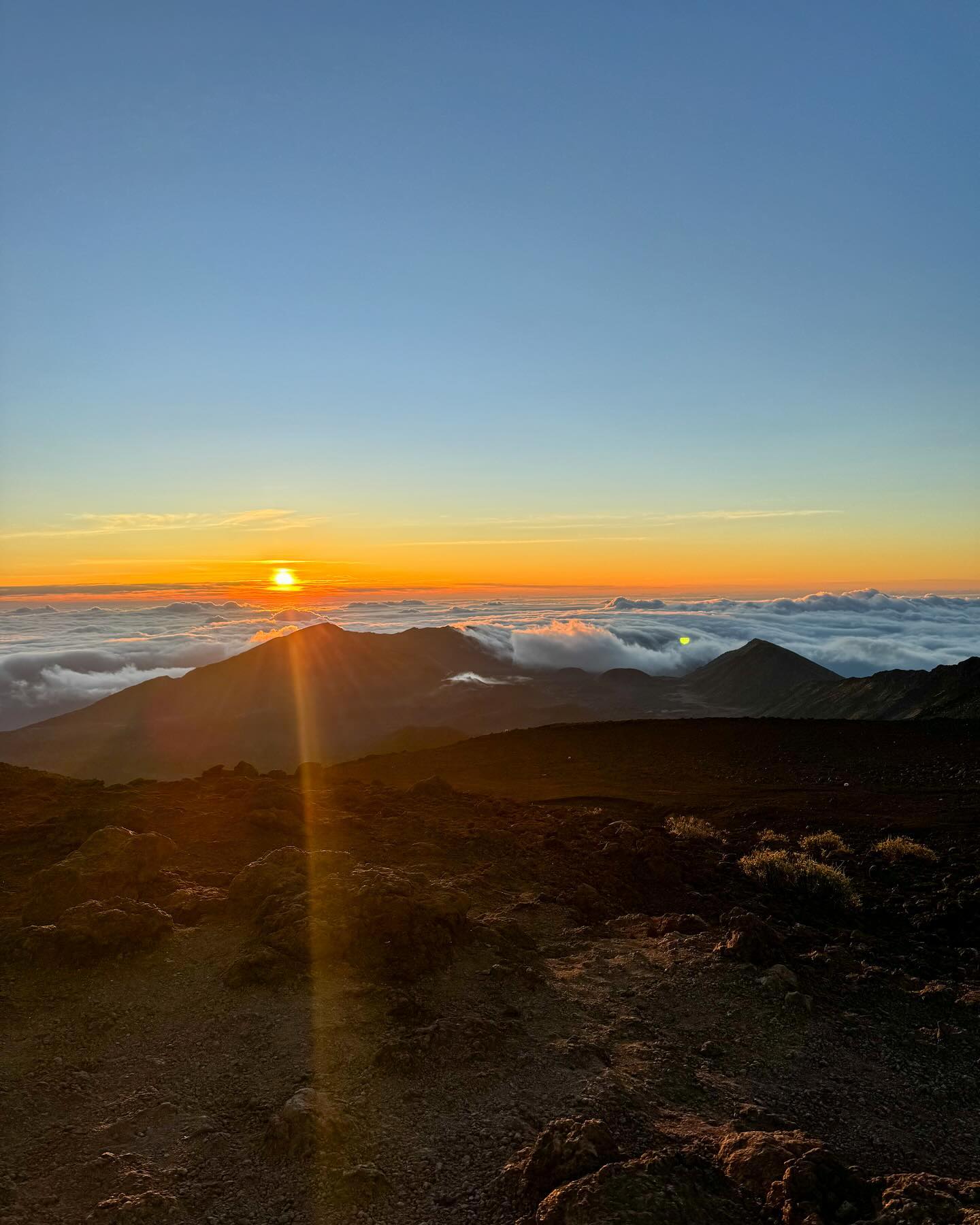
Native Hawaiians revere Haleakalā as a deeply sacred site and a living ancestor. The mountain's name translates to "House of the Sun." According to Hawaiian tradition, the demigod Maui stood at the summit and lassoed the sun's rays to slow its passage across the sky. This act lengthened the day, allowing his mother Hina enough sunlight to dry her kapa (bark cloth). The summit remains a place where the physical realm closely intersects with the spiritual world.
The volcanic stones themselves embody the creative force of Pele, the goddess of fire and volcanoes. High-elevation areas served as sites for sacred piko ceremonies. Families would bring the umbilical cords of their newborn children to the summit, hiding them in the rocks. This practice forged a permanent, spiritual connection between the child and the mountain, grounding them to their ancestral lands. The extreme isolation of the summit made it an ideal location for priests to conduct specialized training and rituals away from the coastal villages.
Modern access requires respect for these traditions. The summit remains an active place of worship and protocol for Native Hawaiians today. Chants and ceremonies frequently take place at sunrise, welcoming the new day. Park rangers instruct visitors to keep their voices low, stay on marked trails, and never move or remove rocks. Stacking rocks to create cairns disrupts the natural landscape and disrespects the cultural significance of the site. Taking lava rocks, sand, or any natural material from the park violates federal law and deeply offends local cultural practices. Visitors who observe these protocols help preserve the spiritual integrity of Haleakalā for future generations.
The summit is frequently 30 to 50 degrees Fahrenheit colder than the coastal beaches at sea level.
The 10,023-foot elevation and lack of light pollution make the summit a premier site for stargazing and telescope observation.
The park contains zero restaurants, food stands, or gas stations, requiring visitors to pack all necessary supplies.
Vehicles entering the summit between 3:00 am and 7:00 am must have a pre-booked $1.00 reservation via Recreation.gov.
The Sliding Sands trail features loose red cinder created by iron oxide, heavily resembling the surface of Mars.
The park provides critical protected habitat for the nēnē, a rare endemic Hawaiian goose that often crosses the winding park roads.
The steep, 10-mile climb drains EV batteries rapidly, often stranding drivers before they reach the top since there are no charging stations.
You only need a reservation if you plan to enter the Summit District between 3:00 am and 7:00 am for sunrise. This costs $1.00 per vehicle via Recreation.gov. Entry at any other time of day requires only the standard $30 entrance fee.
The drive from Kahului Airport covers 38 miles and takes between 1.5 and 2.5 hours. The Haleakalā Highway is steep and winding, requiring drivers to navigate numerous switchbacks in the dark if arriving for sunrise.
The Pools of ʻOheʻo are currently closed to swimming due to severe safety hazards, including flash floods and rockfalls. Visitors can view the cascading pools safely from the 0.5-mile Kūloa Point Trail.
Pack a heavy winter jacket, long pants, closed-toe shoes, a beanie, and gloves. Temperatures at the 10,023-foot peak routinely drop near freezing, and high winds make it feel much colder.
Cell service is non-existent inside the crater and extremely limited at all trailheads and visitor centers. Download offline maps and share your itinerary with a trusted contact before driving up the mountain.
Dogs are strictly banned from all hiking trails to protect endangered wildlife. You may bring a leashed pet only on paved pathways, roads, and drive-up campgrounds like Hosmer Grove.
The 2,600-foot deep summit depression is not a true volcanic crater. It formed when two massive erosion valleys, the Koʻolau and Kaupō gaps, eroded inward over centuries and merged at the center of the volcano.
There are no commercial services, gas stations, or food vendors anywhere inside the park boundaries. You must fill your gas tank in Pukalani or Paʻia and pack all your own meals and water.
Puʻu ʻUlaʻula, also known as Red Hill, is the highest peak at 10,023 feet above sea level. An accessible overlook at this location provides panoramic views of the entire 11.25-mile-wide summit depression.
Ascending rapidly from sea level to 10,023 feet can trigger altitude sickness, causing headaches, nausea, and shortness of breath. Individuals with heart or respiratory conditions should consult a doctor before attempting the drive.
Browse verified tours with free cancellation and instant confirmation.
Find Tours